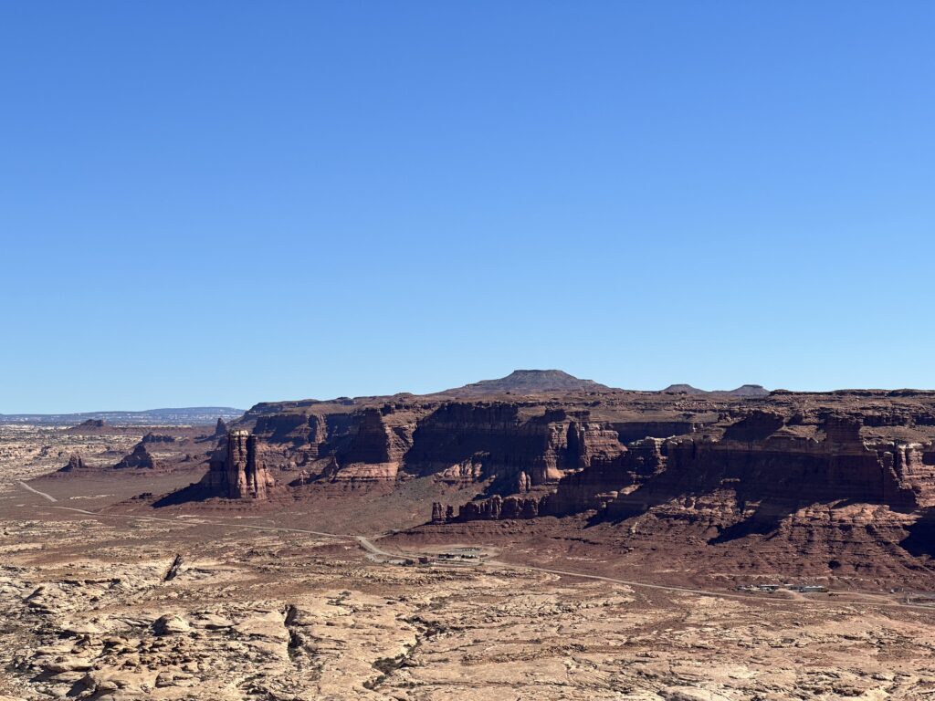
The drive between Monument Valley and Capitol Reef, our destination for tomorrow, should take about 3.5 hours. it took us over 10 because we made a few stops. The general route—UT Hwy 95 and UT Hwy 24–has one jaw-droppingly gorgeous vista after another, wending in and out of canyons and up and down mesas. Extraordinary and highly recommended.
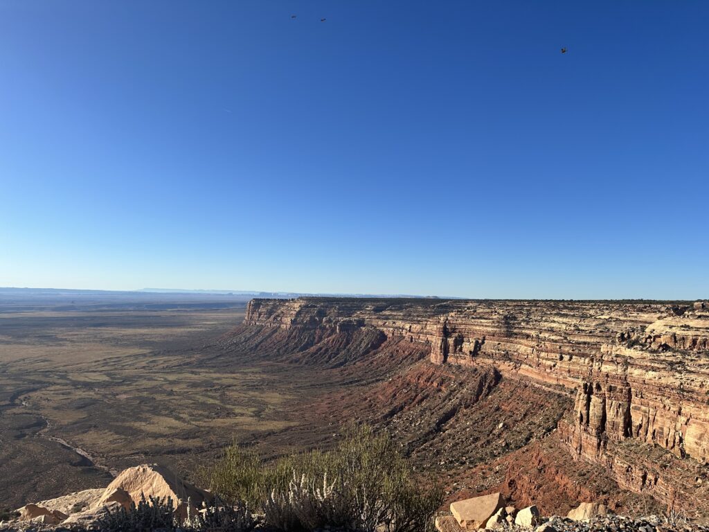
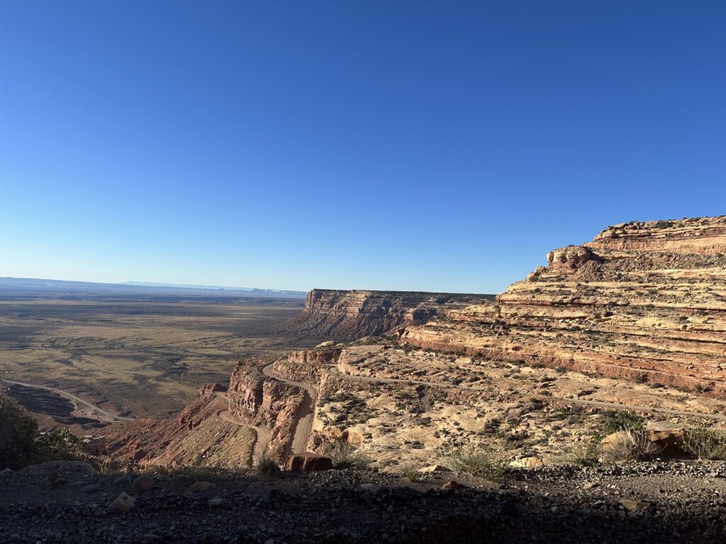
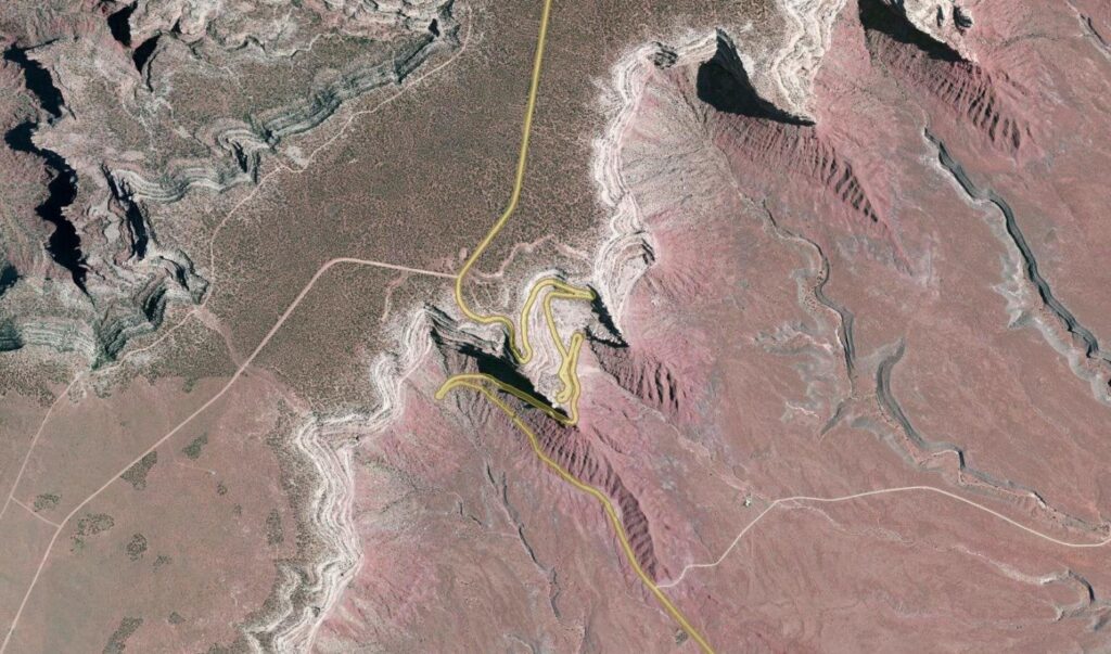
Bears Ears National Monument
We had planned hiking stops in Natural Bridges National Monument and Goblin Valley State Park (Utah), but the route we chose took us through Bear’s Ears National Monument, a nice bonus. There are two ways to cross Bear’s Ears from Monument Valley—the well-engineered UT Hwy 95 or the other way—UT 261, which switchbacks sharply up a 10% grade across the southern wall of Cedar Plateau. The gravel road is narrow, filled with washboard ripples much of the way, and has a few white-knuckle spots, but it also provides glorious views. We know because this is the route we chose. In a rented Chrysler Pacifica van. With lots of cupholders.
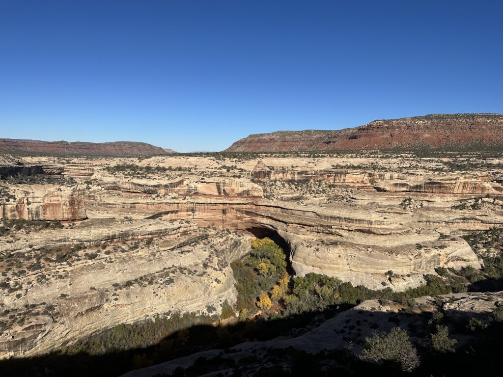
Natural Bridges National Monument
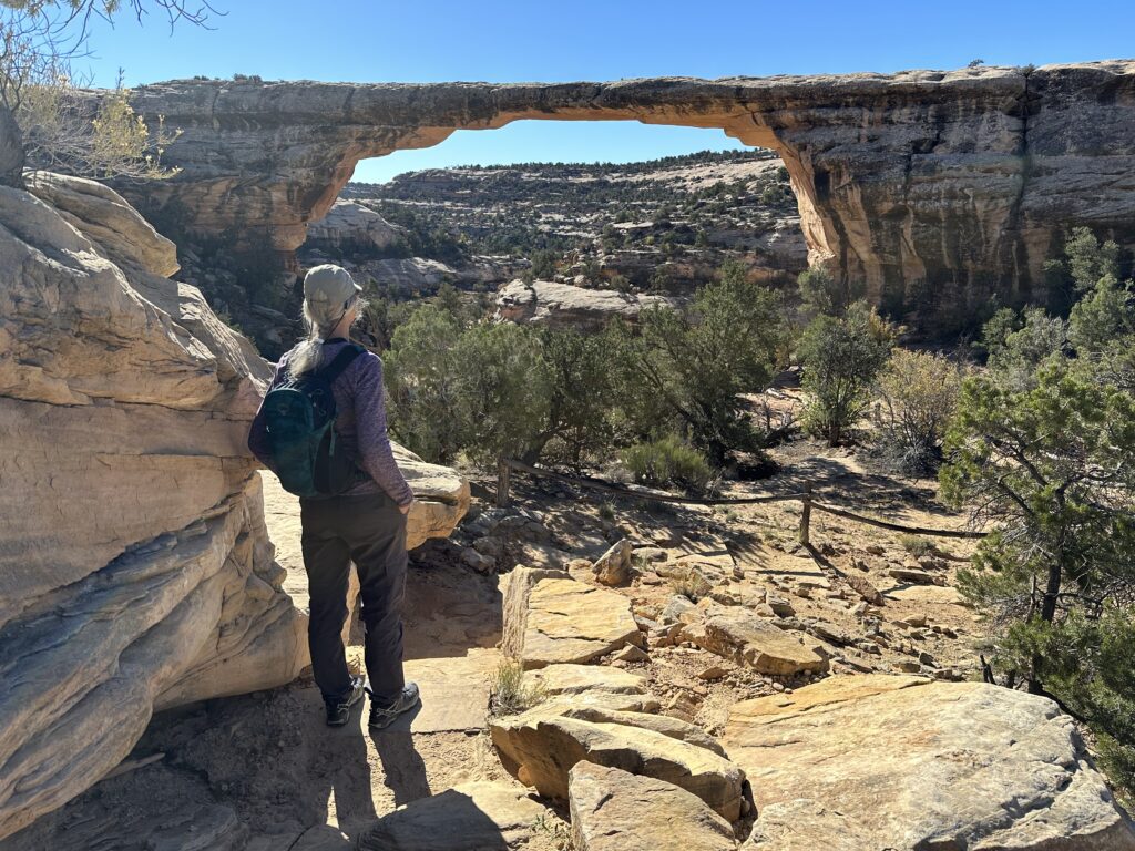
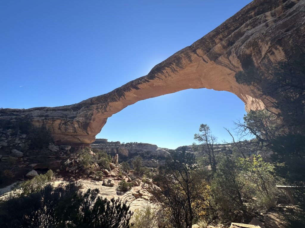
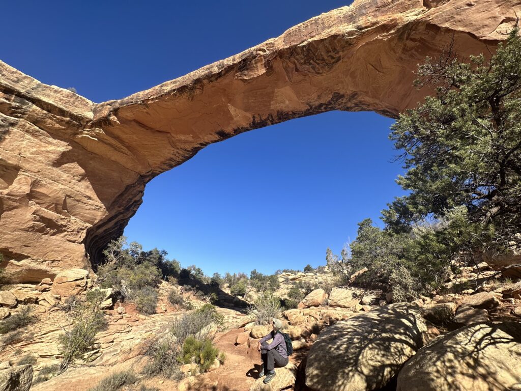
Chalk up another hidden gem for this trip. Natural Bridges is a beautifully designed and maintained area whose main attraction is a nine-mile driving loop around several intersecting canyons that provides views and hiking access to three huge natural bridges, including the second largest in the World after Rainbow Bridge in Glen Canyon, UT. All of the bridges may be accessed by hiking (or climbing, in one case) down to them, and there are loop trails that follow the canyon floors and allow access to all of them.
Given the time we had, we chose the relatively easy hike down to Owachomo bridge, steep but even and less than a mile one way. Well worth it, as you can probably tell.
The two other bridges are more remote and challenging to reach, but you can view them from the loop road.

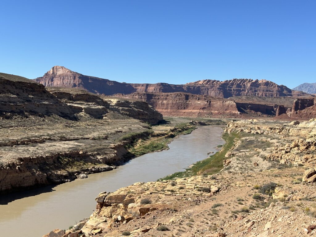
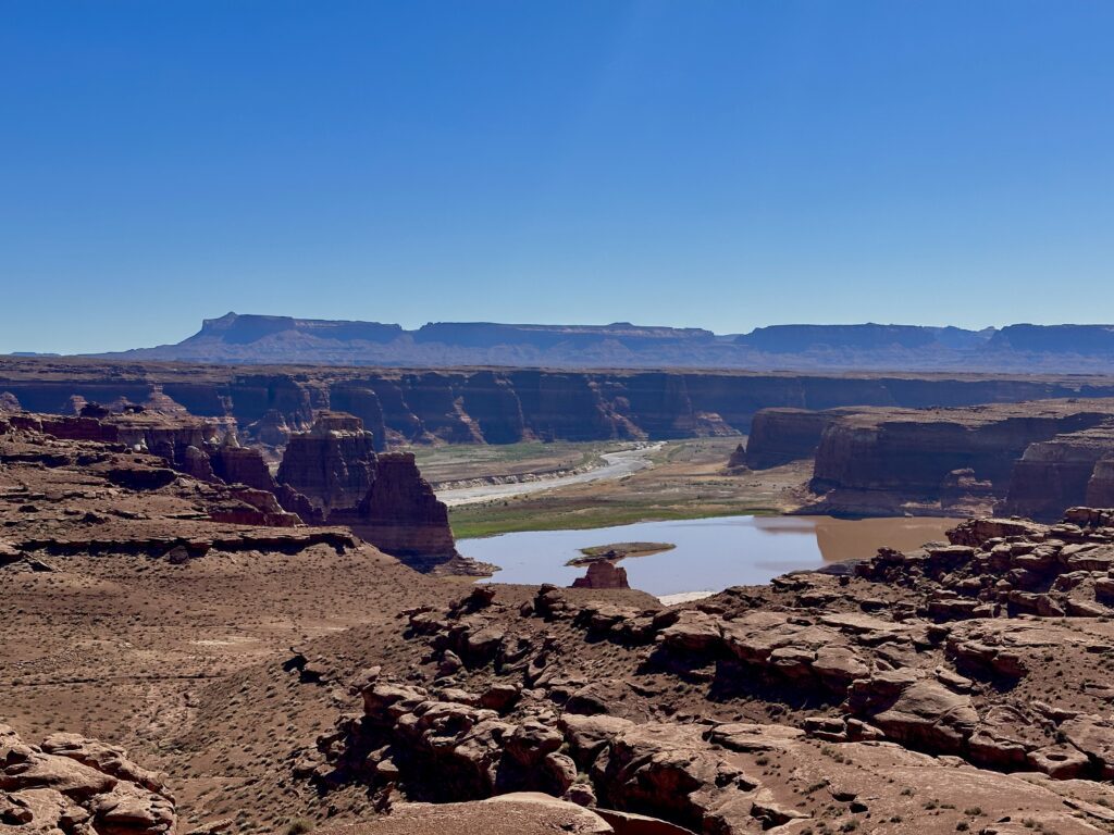
Glen Canyon National Recreation Area
Our route took us through Glen Canyon NRA, an impossibly beautiful series of river canyons and dramatic sculpted sandstone edifices which was flooded when Lake Powell was created in 1963 with the construction of the Glen Canyon Dam on the Colorado River. We stopped for a picnic lunch and a few overlooks, but didn’t spend any time exploring the area.
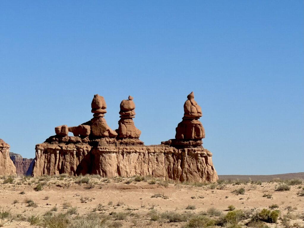
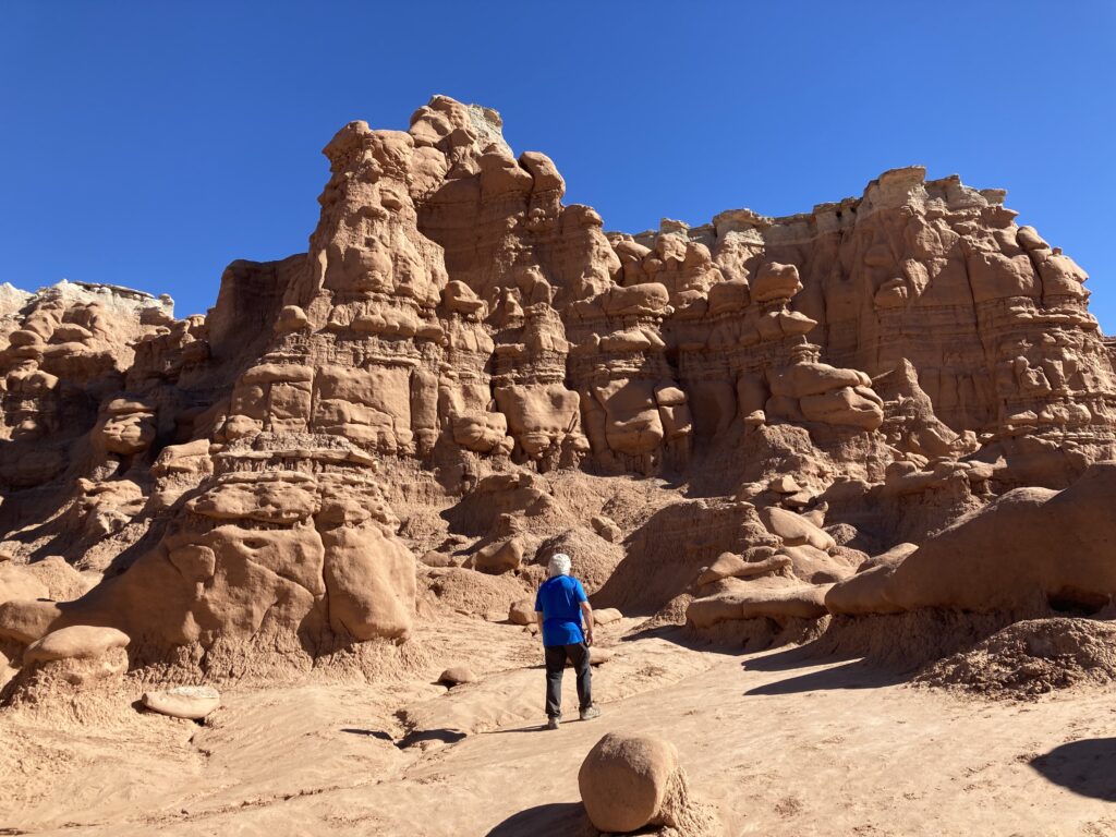
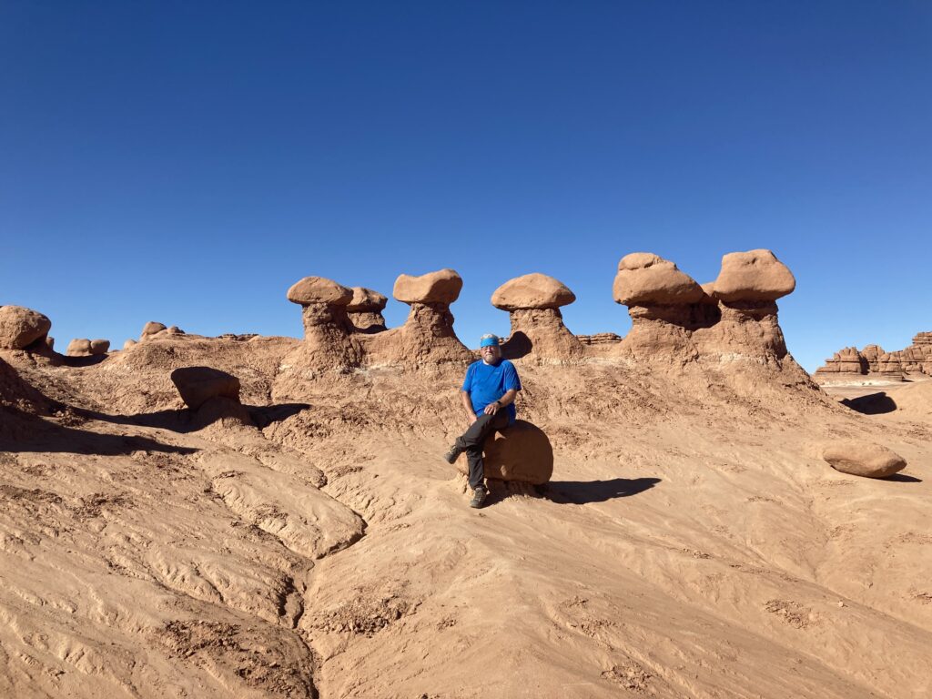
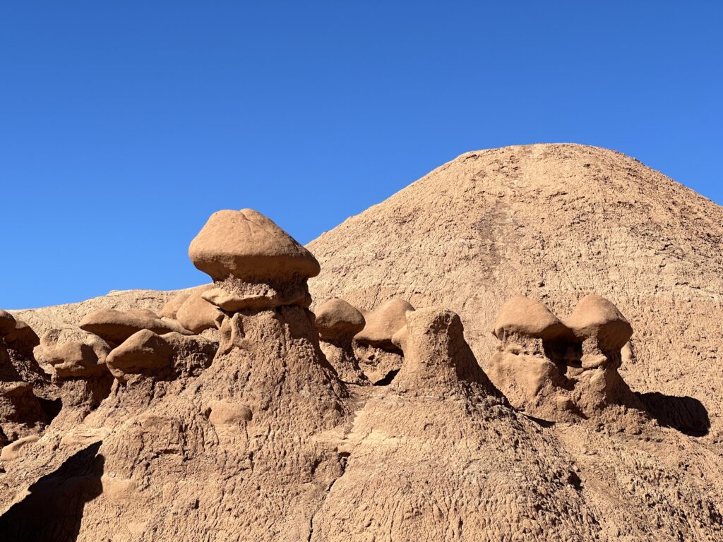
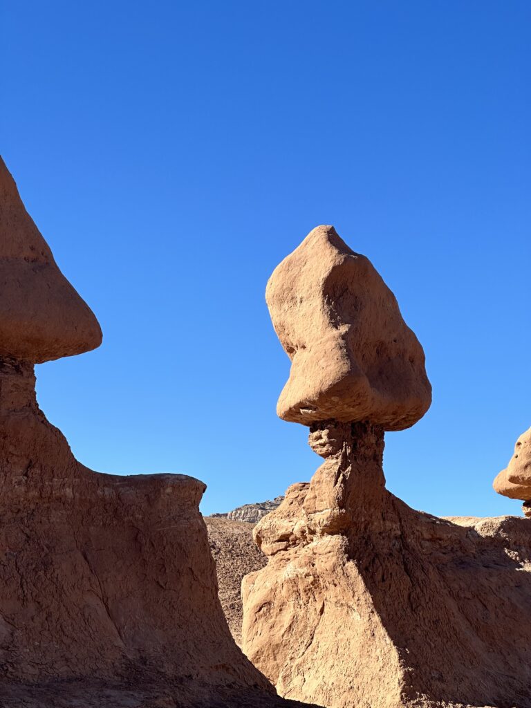
Goblin Valley State Park
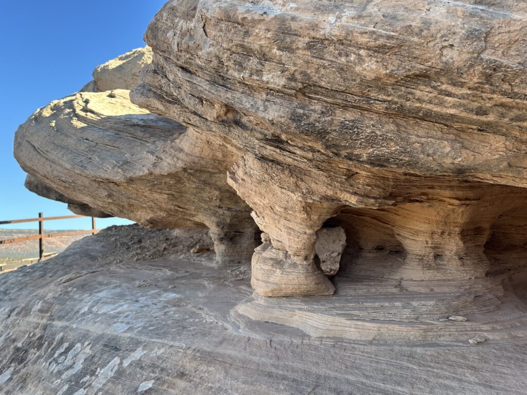
This has been a bucket list item for me for many years, so it was a treat to be able to visit it and get in some good hiking on such a beautiful day. The park, along with Bryce Canyon NP, is the best place in the world to get up close and personal with hoodoos, or goblins as they are called here—spires and ridges of multiple layers of sandstone, silt, and shale deposited when this area was the floor of the Belt inland sea which have eroded into strange otherworldly shapes. Harder sandstone covers the much softer silt and shale layers, which erode more quickly than the sandstone. You’re allowed to wander freely in and amongst the hoodoos, which we gladly did.

Tomorrow, Capitol Reef NP. We drove through part of it on the way to out little motel in Bicknell. I may not sleep tonight…