I thought I was done with blog entries, but it turns out that Scenic Byway 12 continues on past Escalante through part of Bryce Canyon National Park and back into the Dixie National Forest and a beautiful and intriguing hiking area called Red Canyon. We had visited Bryce some years ago, but it was sorely tempting to drive all the way in again. We didn’t, opting instead for our original plan of driving back to the SLC airport over the Mount Nebo Scenic Byway. Utah does their scenic byways right.
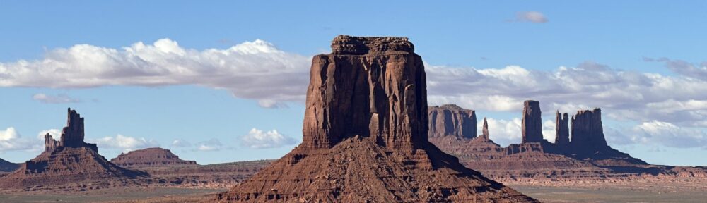
I can’t say enough about Scenic Byway 12. Starting south at Torrey UT, it passes through national parks, monuments, national forests, small towns, and public lands showcasing a variety of landscapes—mesas, canyons, rivers, sandstone sculptures—which change constantly, each more breathtaking than the previous. It goes right back on the bucket list as we’re doing it again for sure.
And while we’re doing routes, the same can be said about UT HWY 95/24 from Bear’s Ears to Bicknell. Mind-numbing sights around every bend.
Just past Bryce going west you reenter Dixie National Forest, and specifically Red Canyon—a stunning, colorful series of small canyons with several options for hiking. Never having heard of it before, it didn’t fit our schedule, but next time we drive Scenic Byway 12, we stop for some hiking. The images below are from turnouts on the byway.
Mount Nebo Scenic Byway was another treat. It snakes its way up (and I do mean ”up”) Mount Nebo through the ubiquitous Dixie National Forest. Nebo itself is over 11,000 ft. The highest point you drive over is about 9500 ft. It’s described as a photographer’s dream and well worth leaving I-15 (any excuse will do for that as far as I’m concerned) and spending some slow time snaking around the many curves and switchbacks for 37 or so miles. We caught it on a beautiful fall day with lots of color in the aspens and oaks.
Some pictures follow, with more in the Photo Archive. This really is the last blog entry. The only place we can go from here is a shuttle to the airport tomorrow morning.
What an incredible ten days, though.


